
Thank you for supporting this site ❤️
Make a donation
Make a donation
Gear up for your next adventure:
As an Amazon Associate, this site earns from qualifying purchases at no extra cost to you.
Hillview topographic map
Click on the map to display elevation.
Thank you for supporting this site ❤️
Make a donation
Make a donation
Gear up for your next adventure:
As an Amazon Associate, this site earns from qualifying purchases at no extra cost to you.
About this map
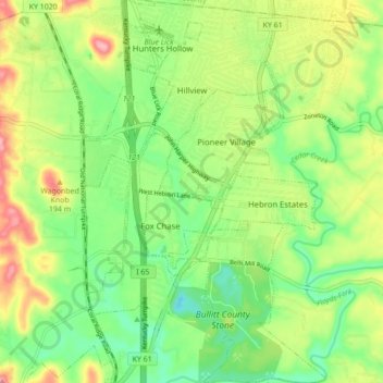
Name: Hillview topographic map, elevation, terrain.
Location: Hillview, Bullitt County, Kentucky, 40129, United States (38.01750 -85.71003 38.08584 -85.65524)
Average elevation: 531 ft
Minimum elevation: 371 ft
Maximum elevation: 774 ft
Bullitt County trails, hiking, mountain biking, running and outdoor activities
Thank you for supporting this site ❤️
Make a donation
Make a donation
Gear up for your next adventure:
As an Amazon Associate, this site earns from qualifying purchases at no extra cost to you.