Geolocate

Mile topographic map

Click on the map to display elevation.

About this map
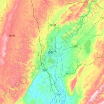
Name: Mile topographic map, elevation, terrain.

Location: Mile, Mile City, Honghe, Yunnan, China (24.25392 103.25270 24.57392 103.57270)

Average elevation: 5,735 ft

Minimum elevation: 4,465 ft

Maximum elevation: 7,503 ft

Gear up for your next adventure:

🌎3D Topographic Globes - Raised relief globes for a tactile understanding of geography
🧴Hand Sanitizer - Keep hands clean while hiking
🏫Relief Map Kits - Hands-on tools for teaching landforms and elevation
📦Gear Storage Bags - Organize and protect outdoor equipment
🌡️Portable Weather Meter - Track weather conditions on the trail

As an Amazon Associate, this site earns from qualifying purchases at no extra cost to you.