
Mönsterås kommun topographic map
Interactive map
Click on the map to display elevation.
About this map
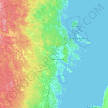
Name: Mönsterås kommun topographic map, elevation, terrain.
Location: Mönsterås kommun, Kalmar County, Sweden (56.87648 16.12045 57.24508 16.76405)
Average elevation: 85 ft
Minimum elevation: -3 ft
Maximum elevation: 358 ft
Other topographic maps
Click on a map to view its topography, its elevation and its terrain.