
Toppel topographic map
Interactive map
Click on the map to display elevation.
About this map
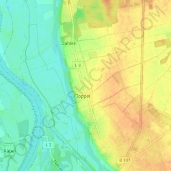
Name: Toppel topographic map, elevation, terrain.
Location: Toppel, Havelberg, Stendal, Sachsen-Anhalt, Deutschland (52.83593 12.03224 52.86364 12.10299)
Average elevation: 121 ft
Minimum elevation: 69 ft
Maximum elevation: 177 ft
Other topographic maps
Click on a map to view its topography, its elevation and its terrain.
Haus der Flüsse
Deutschland > Sachsen-Anhalt > Stendal > Havelberg
Haus der Flüsse, Havelberg, Stendal, Sachsen-Anhalt, 39539, Deutschland
Average elevation: 102 ft