
Semnan topographic map
Interactive map
Click on the map to display elevation.
About this map
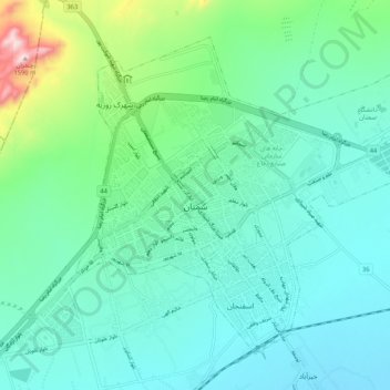
Name: Semnan topographic map, elevation, terrain.
Location: Semnan, بخش مرکزی, Semnan County, Semnan Province, Iran (35.55115 53.35622 35.62026 53.46076)
Average elevation: 3,848 ft
Minimum elevation: 3,540 ft
Maximum elevation: 5,210 ft