
Corregimiento El Paso topographic map
Interactive map
Click on the map to display elevation.
About this map
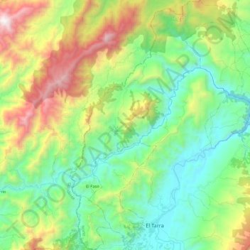
Name: Corregimiento El Paso topographic map, elevation, terrain.
Average elevation: 2,320 ft
Minimum elevation: 440 ft
Maximum elevation: 6,394 ft
Other topographic maps
Click on a map to view its topography, its elevation and its terrain.
Vereda La Paz
Colombia > Norte de Santander > El Tarra
Vereda La Paz, Corregimiento Filogringo, El Tarra, Norte, Norte de Santander, Colombia
Average elevation: 1,299 ft