
招贤镇 topographic map
Interactive map
Click on the map to display elevation.
About this map
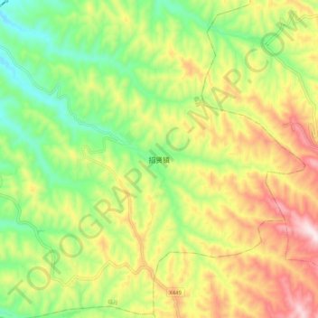
Name: 招贤镇 topographic map, elevation, terrain.
Location: 招贤镇, 临县, 吕梁市, 山西省, 中国 (37.62618 110.90072 37.70618 110.98072)
Average elevation: 3,258 ft
Minimum elevation: 2,484 ft
Maximum elevation: 4,252 ft
Other topographic maps
Click on a map to view its topography, its elevation and its terrain.