Cascada de Belén topographic map
Interactive map
Click on the map to display elevation.
About this map
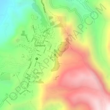
Name: Cascada de Belén topographic map, elevation, terrain.
Average elevation: 6,171 ft
Minimum elevation: 4,780 ft
Maximum elevation: 7,530 ft

Click on the map to display elevation.
Name: Cascada de Belén topographic map, elevation, terrain.
Average elevation: 6,171 ft
Minimum elevation: 4,780 ft
Maximum elevation: 7,530 ft