
San Jerónimo topographic map
Interactive map
Click on the map to display elevation.
About this map
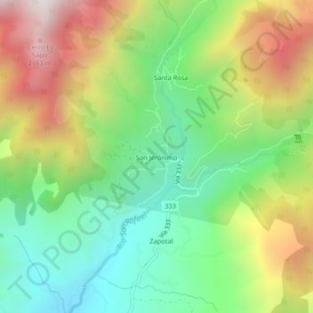
Name: San Jerónimo topographic map, elevation, terrain.
Average elevation: 4,701 ft
Minimum elevation: 2,966 ft
Maximum elevation: 7,306 ft
Other topographic maps
Click on a map to view its topography, its elevation and its terrain.
La Colonia
Costa Rica > Cantón Pérez Zeledón > San Pedro
La Colonia, San Pedro, Cantón Pérez Zeledón, Provincia San José, 11905, Costa Rica
Average elevation: 3,465 ft