
Thank you for supporting this site ❤️
Make a donation
Make a donation
Gear up for your next adventure:
As an Amazon Associate, this site earns from qualifying purchases at no extra cost to you.
Zillertal topographic map
Click on the map to display elevation.
Thank you for supporting this site ❤️
Make a donation
Make a donation
Gear up for your next adventure:
As an Amazon Associate, this site earns from qualifying purchases at no extra cost to you.
About this map
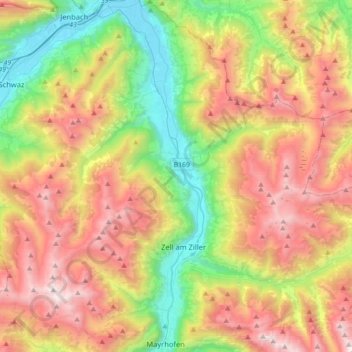
Name: Zillertal topographic map, elevation, terrain.
Location: Zillertal, Kaltenbach, Bezirk Schwaz, Tyrol, Austria (47.16204 11.82069 47.40245 11.89802)
Average elevation: 4,918 ft
Minimum elevation: 1,706 ft
Maximum elevation: 8,976 ft
Thank you for supporting this site ❤️
Make a donation
Make a donation
Gear up for your next adventure:
As an Amazon Associate, this site earns from qualifying purchases at no extra cost to you.
Other topographic maps
Click on a map to view its topography, its elevation and its terrain.