Geolocate

Boudh topographic map

Click on the map to display elevation.

About this map

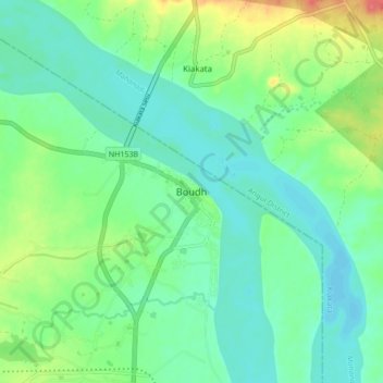
Name: Boudh topographic map, elevation, terrain.

Location: Boudh, Baudh Sadar, Boudh District, Odisha, 762014, India (20.80156 84.28133 20.88156 84.36133)

Average elevation: 305 ft

Minimum elevation: 246 ft

Maximum elevation: 453 ft

Gear up for your next adventure:

🏥Hiking First Aid Kits - Comprehensive medical kits for remote trail injuries
🥾Women's Hiking Boots - Top-rated trail boots with ankle support and superior grip
🧭Compass with Lanyard - Easy‑carry compass for navigation
🛌Ultralight Sleeping Bags - Compact down bags for cold nights in the wilderness
🪶Multi‑Purpose Knife - Useful blade for camp and trail

As an Amazon Associate, this site earns from qualifying purchases at no extra cost to you.