
Curbar CP topographic map
Interactive map
Click on the map to display elevation.
About this map
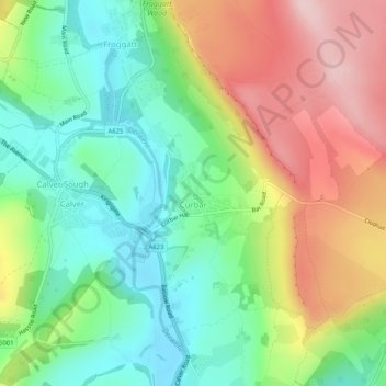
Name: Curbar CP topographic map, elevation, terrain.
Average elevation: 705 ft
Minimum elevation: 367 ft
Maximum elevation: 1,201 ft
Other topographic maps
Click on a map to view its topography, its elevation and its terrain.
Earl Sterndale
Vereinigtes Königreich > England > Derbyshire > Derbyshire Dales
Earl Sterndale, Derbyshire Dales, Derbyshire, England, SK17 0BY, Vereinigtes Königreich
Average elevation: 1,132 ft