
Johnson Creek topographic map
Click on the map to display elevation.
About this map
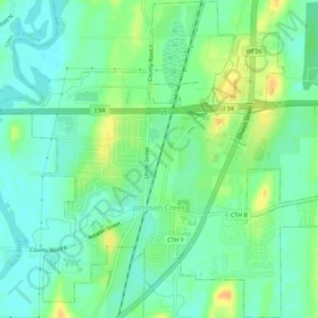
Name: Johnson Creek topographic map, elevation, terrain.
Location: Johnson Creek, Jefferson County, Wisconsin, United States (43.06457 -88.79244 43.09752 -88.74705)
Average elevation: 817 ft
Minimum elevation: 774 ft
Maximum elevation: 886 ft
Jefferson County trails, hiking, mountain biking, running and outdoor activities
Other topographic maps
Click on a map to view its topography, its elevation and its terrain.
Aztalan State Park
United States > Wisconsin > Jefferson County > Town of Aztalan
Average elevation: 837 ft