
Yécora topographic map
Interactive map
Click on the map to display elevation.
About this map
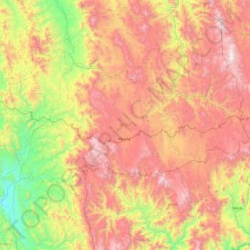
Name: Yécora topographic map, elevation, terrain.
Location: Yécora, Sonora, 85780, México (28.18153 -109.36695 28.64488 -108.47970)
Average elevation: 4,245 ft
Minimum elevation: 991 ft
Maximum elevation: 7,959 ft
Other topographic maps
Click on a map to view its topography, its elevation and its terrain.