
Thank you for supporting this site ❤️
Make a donation
Make a donation
Gear up for your next adventure:
As an Amazon Associate, this site earns from qualifying purchases at no extra cost to you.
Sopo topographic map
Click on the map to display elevation.
Thank you for supporting this site ❤️
Make a donation
Make a donation
Gear up for your next adventure:
As an Amazon Associate, this site earns from qualifying purchases at no extra cost to you.
About this map
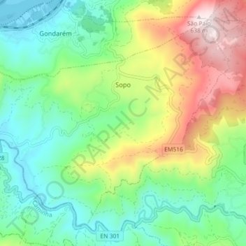
Name: Sopo topographic map, elevation, terrain.
Location: Sopo, Vila Nova de Cerveira, Viana do Castelo, Portugal (41.87620 -8.77747 41.92095 -8.70578)
Average elevation: 705 ft
Minimum elevation: 0 ft
Maximum elevation: 2,077 ft
Thank you for supporting this site ❤️
Make a donation
Make a donation
Gear up for your next adventure:
As an Amazon Associate, this site earns from qualifying purchases at no extra cost to you.