
Olbendorf topographic map
Interactive map
Click on the map to display elevation.
About this map
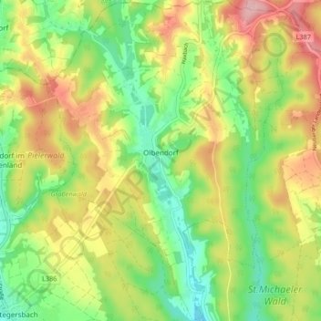
Name: Olbendorf topographic map, elevation, terrain.
Location: Olbendorf, Güssing, Burgenland, 7534, Österreich (47.15813 16.17675 47.21439 16.23793)
Average elevation: 1,014 ft
Minimum elevation: 778 ft
Maximum elevation: 1,312 ft