
Provincia de Chiclayo topographic map
Interactive map
Click on the map to display elevation.
About this map
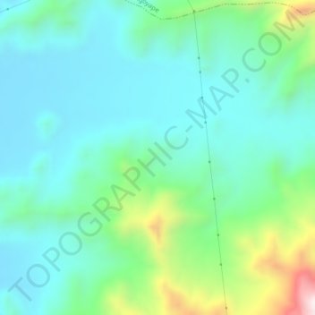
Name: Provincia de Chiclayo topographic map, elevation, terrain.
Location: Provincia de Chiclayo, Pucalá, Chiclayo, Lambayeque, Perú (-6.81940 -79.51432 -6.77940 -79.47432)
Average elevation: 1,142 ft
Minimum elevation: 577 ft
Maximum elevation: 3,064 ft
Other topographic maps
Click on a map to view its topography, its elevation and its terrain.
Laguna Collique
Perú > Lambayeque > Pucalá > San Sebastián
Laguna Collique, San Sebastián, Pucalá, Provincia de Chiclayo, Lambayeque, Perú
Average elevation: 387 ft
Santa Rosa de Collique
Perú > Lambayeque > Pucalá > Santa Rosa de Collique
Santa Rosa de Collique, Pucalá, Provincia de Chiclayo, Lambayeque, Perú
Average elevation: 463 ft