Geolocate

Reynosa topographic map

Click on the map to display elevation.

About this map

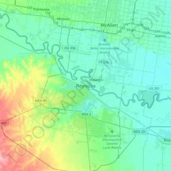
Name: Reynosa topographic map, elevation, terrain.

Location: Reynosa, Tamaulipas, 88500, Mexico (25.93077 -98.43882 26.25077 -98.11882)

Average elevation: 151 ft

Minimum elevation: 75 ft

Maximum elevation: 440 ft

Gear up for your next adventure:

📚USA Hiking Guide Books - Top trail guides and map books
🚪Portable Camp Chair - Foldable chair for comfort at camp
🥾Hiking Shoes - Durable and comfortable shoes for trail hiking
🏫Relief Map Kits - Hands-on tools for teaching landforms and elevation
🔌Solar Panel Charger - Charge gear sustainably outdoors

As an Amazon Associate, this site earns from qualifying purchases at no extra cost to you.