Geolocate

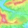
Jestetten topographic map

Click on the map to display elevation.

About this map
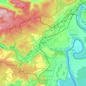
Name: Jestetten topographic map, elevation, terrain.

Location: Jestetten, GVV Jestetten, Landkreis Waldshut, Baden-Württemberg, 79798, Germany (47.62630 8.52694 47.67272 8.62895)

Average elevation: 1,558 ft

Minimum elevation: 1,129 ft

Maximum elevation: 2,162 ft

Other topographic maps

Click on a map to view its topography, its elevation and its terrain.

Domer

Germany > Baden-Württemberg > Landkreis Waldshut > Oberalpfen

Average elevation: 2,274 ft

Bühl

Germany > Baden-Württemberg > Landkreis Waldshut

Average elevation: 1,693 ft

Schwerzen

Germany > Baden-Württemberg > Landkreis Waldshut

Average elevation: 1,391 ft

Spießhorn

Germany > Baden-Württemberg > Landkreis Waldshut

Average elevation: 3,684 ft

Mättle

Germany > Baden-Württemberg > Landkreis Waldshut > Todtmoos

Average elevation: 3,284 ft

Gear up for your next adventure:

🎒Waterproof Dry Bags - Keep your electronics and maps dry inside your pack
❄️Traction Cleats - Prevent slips on icy trails during winter hikes
🪑Portable Camp Table - Compact table for campsite meals
🥄Camping Utensil Set - Lightweight utensils for outdoor meals
🪶Compact Camp Shovel - Folding shovel for campsite tasks

As an Amazon Associate, this site earns from qualifying purchases at no extra cost to you.