
Thank you for supporting this site ❤️
Make a donation
Make a donation
Gear up for your next adventure:
As an Amazon Associate, this site earns from qualifying purchases at no extra cost to you.
Piancavallo topographic map
Click on the map to display elevation.
Thank you for supporting this site ❤️
Make a donation
Make a donation
Gear up for your next adventure:
As an Amazon Associate, this site earns from qualifying purchases at no extra cost to you.
About this map
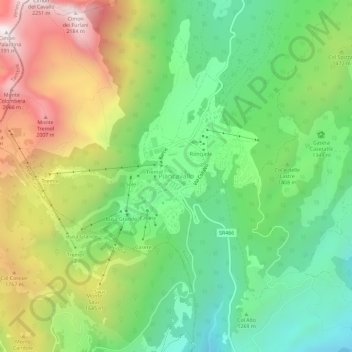
Name: Piancavallo topographic map, elevation, terrain.
Location: Piancavallo, Aviano, Pordenone, Friuli-Venezia Giulia, Italy (46.08927 12.49906 46.12927 12.53906)
Average elevation: 4,662 ft
Minimum elevation: 3,100 ft
Maximum elevation: 7,110 ft
Thank you for supporting this site ❤️
Make a donation
Make a donation
Gear up for your next adventure:
As an Amazon Associate, this site earns from qualifying purchases at no extra cost to you.
Other topographic maps
Click on a map to view its topography, its elevation and its terrain.