
Lago Rosario topographic map
Interactive map
Click on the map to display elevation.
About this map
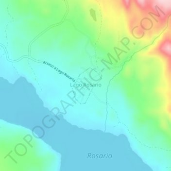
Name: Lago Rosario topographic map, elevation, terrain.
Location: Lago Rosario, Departamento Futaleufú, Chubut, Argentina (-43.24947 -71.35192 -43.24376 -71.34558)
Average elevation: 2,349 ft
Minimum elevation: 2,162 ft
Maximum elevation: 2,930 ft