
Make a donation
Gear up for your next adventure:
As an Amazon Associate, this site earns from qualifying purchases at no extra cost to you.
Natanz topographic map
Click on the map to display elevation.
Make a donation
Gear up for your next adventure:
As an Amazon Associate, this site earns from qualifying purchases at no extra cost to you.
Natanz
Natanz is located 120 km northeast of Isfahan and on the main north-south highway of Iran. Its altitude is 1666 meters above sea level. The distance between Tehran and Natanz is 326 km, and it takes about 4 hours by car. The Karkas mountain chain (Kuh-e Karkas) (meaning mountain of vultures), at an elevation of 3,899 meters, rises above the town.
Make a donation
Gear up for your next adventure:
As an Amazon Associate, this site earns from qualifying purchases at no extra cost to you.
About this map
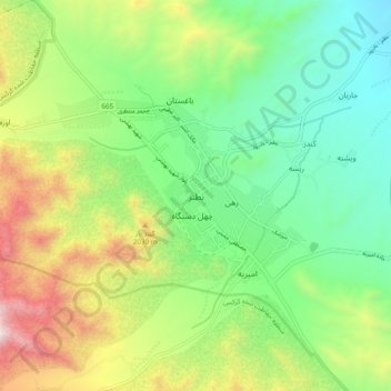
Name: Natanz topographic map, elevation, terrain.
Average elevation: 5,823 ft
Minimum elevation: 4,573 ft
Maximum elevation: 8,127 ft
Make a donation
Gear up for your next adventure:
As an Amazon Associate, this site earns from qualifying purchases at no extra cost to you.