Geolocate

Jamestown topographic map

Click on the map to display elevation.

About this map

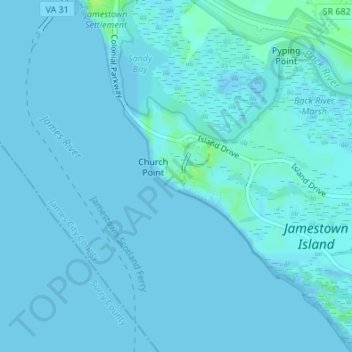
Name: Jamestown topographic map, elevation, terrain.

Location: Jamestown, James City County, Virginia, 23081, United States (37.19892 -76.78830 37.21892 -76.76830)

Average elevation: 3 ft

Minimum elevation: -7 ft

Maximum elevation: 36 ft

James City County trails, hiking, mountain biking, running and outdoor activities

Other topographic maps

Click on a map to view its topography, its elevation and its terrain.

Gear up for your next adventure:

🔊Portable Camp Speaker - Music and alerts at camp
🕶️Glacier Sunglasses - Side shields to protect eyes from high-altitude snow glare
🛏️Cold Weather Sleeping Bag - Warm sleeping bag for cold conditions
🎒Hydration Pack - Hands‑free water reservoir for long hikes
👖Convertible Hiking Pants - Versatile zip-off pants for changing altitudes and temperatures

As an Amazon Associate, this site earns from qualifying purchases at no extra cost to you.