Geolocate

Bances topographic map

Click on the map to display elevation.

About this map

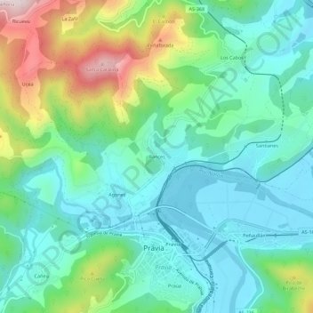
Name: Bances topographic map, elevation, terrain.

Location: Bances, Santianes, Pravia, Asturias, 33120, Spain (43.48125 -6.13336 43.52125 -6.09336)

Average elevation: 420 ft

Minimum elevation: 3 ft

Maximum elevation: 1,535 ft

Other topographic maps

Click on a map to view its topography, its elevation and its terrain.

Arangu

Spain > Asturias > Pravia

Average elevation: 791 ft

Gear up for your next adventure:

🦶Hiking Gaiters - Keep debris and water out of your boots
🪵Folding Camp Saw - Compact saw for wood and campsite work
🛠️Backpacking Tool Kit - Essential toolkit for outdoor repairs
📻Weather Alert Radios - Stay informed of storm risks while off-the-grid
📖Nature Tracking Books - Learn to track wildlife and terrain

As an Amazon Associate, this site earns from qualifying purchases at no extra cost to you.