Geolocate

Punawale topographic map

Click on the map to display elevation.

About this map

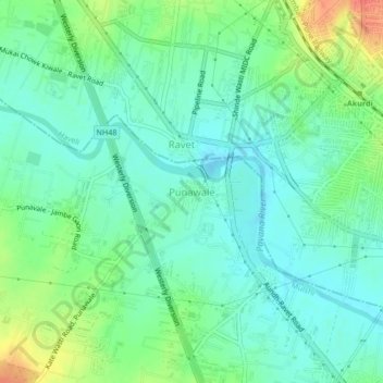
Name: Punawale topographic map, elevation, terrain.

Location: Punawale, Mulshi, Pune District, Maharashtra, 410005, India (18.61829 73.72619 18.65829 73.76619)

Average elevation: 1,886 ft

Minimum elevation: 1,834 ft

Maximum elevation: 1,998 ft

Gear up for your next adventure:

🪵Folding Camp Saw - Compact saw for wood and campsite work
🥄Camping Utensil Set - Lightweight utensils for outdoor meals
📦Gear Storage Bags - Organize and protect outdoor equipment
🪶Camp Gear Gift Set - Perfect gift bundle for outdoor fans
🔭Stargazing Telescopes - Perfect for camping in low-light pollution areas shown on maps

As an Amazon Associate, this site earns from qualifying purchases at no extra cost to you.