
Thank you for supporting this site ❤️
Make a donation
Make a donation
Gear up for your next adventure:
As an Amazon Associate, this site earns from qualifying purchases at no extra cost to you.
Caral topographic map
Click on the map to display elevation.
Thank you for supporting this site ❤️
Make a donation
Make a donation
Gear up for your next adventure:
As an Amazon Associate, this site earns from qualifying purchases at no extra cost to you.
About this map
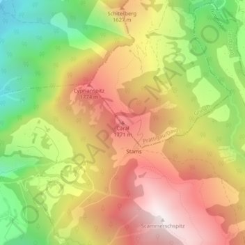
Name: Caral topographic map, elevation, terrain.
Location: Caral, Grüsch, Prättigau/Davos, Grisons, 7202, Switzerland (46.91715 9.60080 46.91725 9.60090)
Average elevation: 4,633 ft
Minimum elevation: 2,477 ft
Maximum elevation: 6,575 ft
Thank you for supporting this site ❤️
Make a donation
Make a donation
Gear up for your next adventure:
As an Amazon Associate, this site earns from qualifying purchases at no extra cost to you.