
Kerrville-Schreiner Park topographic map
Interactive map
Click on the map to display elevation.
About this map
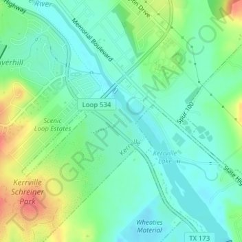
Name: Kerrville-Schreiner Park topographic map, elevation, terrain.
Average elevation: 1,627 ft
Minimum elevation: 1,558 ft
Maximum elevation: 1,772 ft
Other topographic maps
Click on a map to view its topography, its elevation and its terrain.
Guadalupe River
United States > Texas > Kerr County > Kerrville
Guadalupe River, Kerrville, Kerr County, Texas, 78029, United States
Average elevation: 1,673 ft