Geolocate

Kōya topographic map

Click on the map to display elevation.

About this map
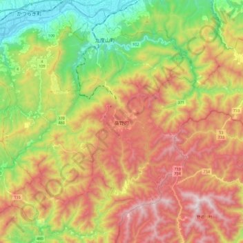
Name: Kōya topographic map, elevation, terrain.

Location: Kōya, Ito County, Wakayama Prefecture, Japan (34.15431 135.51227 34.27827 135.73020)

Average elevation: 1,962 ft

Minimum elevation: 138 ft

Maximum elevation: 3,976 ft

Gear up for your next adventure:

🔋Solar Power Banks - Keep your GPS and phone charged in remote wilderness areas
🎒Trail Energy Bars - High‑calorie bars for hiking energy
🎒Gear Packing Cubes - Organize your backpack efficiently
📶Satellite Messenger - Communication device off‑grid
🎒Trekking Poles - Sturdy poles for balance and stability on rough terrain

As an Amazon Associate, this site earns from qualifying purchases at no extra cost to you.