
Milford topographic map
Interactive map
Click on the map to display elevation.
About this map
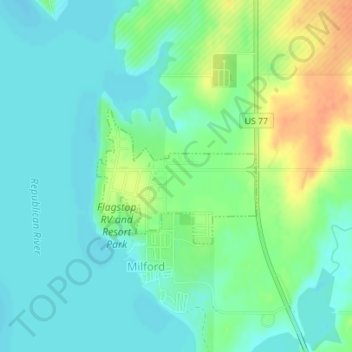
Name: Milford topographic map, elevation, terrain.
Location: Milford, Geary County, Kansas, United States (39.17005 -96.91739 39.18036 -96.90157)
Average elevation: 1,171 ft
Minimum elevation: 1,129 ft
Maximum elevation: 1,257 ft
Other topographic maps
Click on a map to view its topography, its elevation and its terrain.
Grandview Plaza
United States > Kansas > Geary County
Grandview Plaza, Geary County, Kansas, United States
Average elevation: 1,129 ft
Junction City
United States > Kansas > Geary County
Junction City, Geary County, Kansas, United States
Average elevation: 1,155 ft