
塞罕坝广场 topographic map
Interactive map
Click on the map to display elevation.
About this map
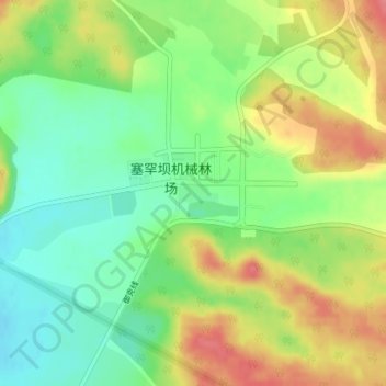
Name: 塞罕坝广场 topographic map, elevation, terrain.
Location: 塞罕坝广场, 千层板社区, 围场满族蒙古族自治县, 承德市, 河北省, 中国 (42.40465 117.25124 42.40602 117.25502)
Average elevation: 4,974 ft
Minimum elevation: 4,859 ft
Maximum elevation: 5,115 ft
Other topographic maps
Click on a map to view its topography, its elevation and its terrain.