
Ripley topographic map
Interactive map
Click on the map to display elevation.
About this map
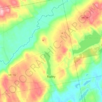
Name: Ripley topographic map, elevation, terrain.
Location: Ripley, Somerset County, Maine, United States (44.96824 -69.48234 45.06715 -69.33095)
Average elevation: 482 ft
Minimum elevation: 262 ft
Maximum elevation: 827 ft
Other topographic maps
Click on a map to view its topography, its elevation and its terrain.
Starks
United States > Maine > Somerset County
Starks, Somerset County, Maine, United States
Average elevation: 423 ft
Fairfield
United States > Maine > Somerset County
Fairfield, Somerset County, Maine, United States
Average elevation: 210 ft