Geolocate

Maredsous topographic map

Click on the map to display elevation.

About this map

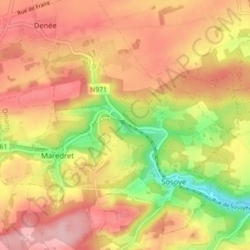
Name: Maredsous topographic map, elevation, terrain.

Location: Maredsous, Sosoye, Anhée, Dinant, Namur, Wallonia, 5537, Belgium (50.28464 4.74948 50.32464 4.78948)

Average elevation: 748 ft

Minimum elevation: 440 ft

Maximum elevation: 955 ft

Gear up for your next adventure:

🧭Pro Hiking Compasses - High-accuracy liquid-filled compasses for topographic orientation
🪑Ultralight Camp Chairs - Portable seating for resting after a long day of mapping
🧯Portable Fire Pit - Compact fire pit for camping spots
🚑Emergency Bivvies - Heat-reflective sleeping bags for survival situations
🛠️Outdoor Gear Repair Kit - Essential tools to fix gear on the trail

As an Amazon Associate, this site earns from qualifying purchases at no extra cost to you.