
South Naknek topographic map
Interactive map
Click on the map to display elevation.
About this map
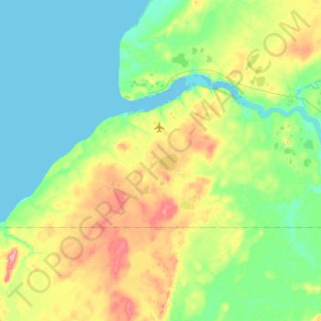
Name: South Naknek topographic map, elevation, terrain.
Location: South Naknek, Bristol Bay, Alaska, 99670, United States (58.60978 -157.26961 58.73440 -156.75770)
Average elevation: 92 ft
Minimum elevation: -16 ft
Maximum elevation: 341 ft
Other topographic maps
Click on a map to view its topography, its elevation and its terrain.
King Salmon
United States > Alaska > Bristol Bay
King Salmon, Bristol Bay, Alaska, United States
Average elevation: 177 ft