
Pajsijevic topographic map
Interactive map
Click on the map to display elevation.
About this map
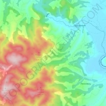
Name: Pajsijevic topographic map, elevation, terrain.
Average elevation: 1,319 ft
Minimum elevation: 722 ft
Maximum elevation: 2,428 ft
Other topographic maps
Click on a map to view its topography, its elevation and its terrain.
Knic
Serbia > Central Serbia > Sumadija Administrative District > Knic Municipality
Knic, Knic Municipality, Sumadija Administrative District, Central Serbia, 34240, Serbia
Average elevation: 974 ft