
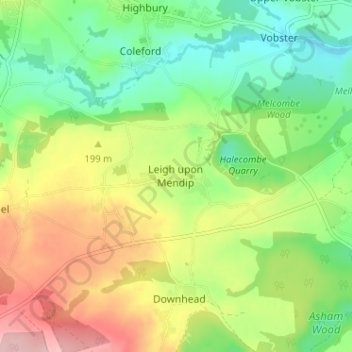
Leigh upon Mendip topographic map
Interactive map
Click on the map to display elevation.
About this map
Name: Leigh upon Mendip topographic map, elevation, terrain.
Location: Leigh upon Mendip, Somerset, England, BA3 5QQ, United Kingdom (51.20406 -2.46461 51.24406 -2.42461)
Average elevation: 581 ft
Minimum elevation: 328 ft
Maximum elevation: 958 ft
Other topographic maps
Click on a map to view its topography, its elevation and its terrain.
Wiveliscombe
United Kingdom > England > Somerset
Wiveliscombe, Somerset, England, United Kingdom
Average elevation: 545 ft
Mells
United Kingdom > England > Somerset
Mells, Somerset, England, United Kingdom
Average elevation: 436 ft
Bridgwater
United Kingdom > England > Somerset
Bridgwater, Somerset, England, United Kingdom
Average elevation: 33 ft
Pawlett
United Kingdom > England > Somerset
Pawlett, Somerset, England, United Kingdom
Average elevation: 20 ft