
Lopikerkapel topographic map
Interactive map
Click on the map to display elevation.
About this map
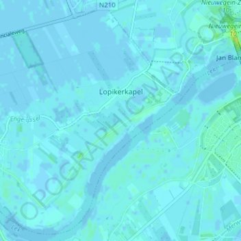
Name: Lopikerkapel topographic map, elevation, terrain.
Location: Lopikerkapel, Lopik, Utrecht, Nederland (51.96916 4.99986 52.00569 5.06264)
Average elevation: 3 ft
Minimum elevation: -10 ft
Maximum elevation: 46 ft