
Horndon topographic map
Interactive map
Click on the map to display elevation.
About this map
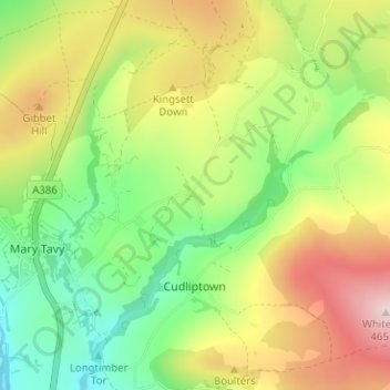
Name: Horndon topographic map, elevation, terrain.
Average elevation: 896 ft
Minimum elevation: 436 ft
Maximum elevation: 1,516 ft
Other topographic maps
Click on a map to view its topography, its elevation and its terrain.
Midlands
United Kingdom > England > Devon > West Devon > Cudliptown
Midlands, Mary Tavy, Cudliptown, West Devon, Devon, England, PL19 9NF, United Kingdom
Average elevation: 830 ft