
Prato Gentile topographic map
Interactive map
Click on the map to display elevation.
About this map
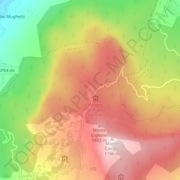
Name: Prato Gentile topographic map, elevation, terrain.
Location: Prato Gentile, Capracotta, Isernia, Molise, 86082, Italia (41.84459 14.26968 41.86459 14.28968)
Average elevation: 4,649 ft
Minimum elevation: 3,376 ft
Maximum elevation: 5,686 ft