
La Coulée Verte topographic map
Interactive map
Click on the map to display elevation.
About this map
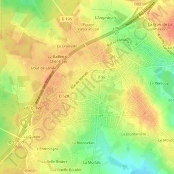
Name: La Coulée Verte topographic map, elevation, terrain.
Average elevation: 305 ft
Minimum elevation: 200 ft
Maximum elevation: 371 ft
Other topographic maps
Click on a map to view its topography, its elevation and its terrain.
Étang de Liffré
Étang de Liffré, R 8, La Haute Gaillardière, Liffré, Rennes, Ille-et-Vilaine, Bretagne, France métropolitaine, 35340, France
Average elevation: 285 ft
Carrefour de la Petite Lune
Carrefour de la Petite Lune, Liffré, Rennes, Ille-et-Vilaine, Bretagne, France métropolitaine, 35340, France
Average elevation: 246 ft