
la Floresta topographic map
Interactive map
Click on the map to display elevation.
About this map
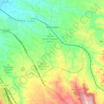
Name: la Floresta topographic map, elevation, terrain.
Location: la Floresta, Garrigas, Lérida, Cataluña, España (41.46614 0.90713 41.52581 0.93874)
Average elevation: 1,230 ft
Minimum elevation: 912 ft
Maximum elevation: 1,736 ft