
Pendueles topographic map
Interactive map
Click on the map to display elevation.
About this map
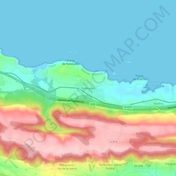
Name: Pendueles topographic map, elevation, terrain.
Location: Pendueles, Llanes, Asturies, 33598, Espagne (43.37634 -4.65668 43.41634 -4.61668)
Average elevation: 243 ft
Minimum elevation: -3 ft
Maximum elevation: 761 ft
Other topographic maps
Click on a map to view its topography, its elevation and its terrain.