
Kalabagh topographic map
Interactive map
Click on the map to display elevation.
About this map
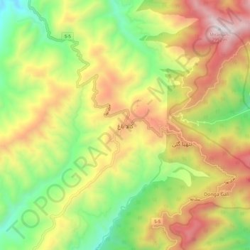
Name: Kalabagh topographic map, elevation, terrain.
Location: Kalabagh, Abbottābād District, Khyber Pakhtunkhwa, Pakistan (34.03414 73.33085 34.11414 73.41085)
Average elevation: 6,962 ft
Minimum elevation: 4,619 ft
Maximum elevation: 9,708 ft