Geolocate

Sandusky topographic map

Click on the map to display elevation.

About this map

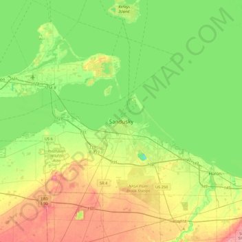
Name: Sandusky topographic map, elevation, terrain.

Location: Sandusky, Erie County, Ohio, 44870, United States (41.29610 -82.87158 41.61610 -82.55158)

Average elevation: 604 ft

Minimum elevation: 479 ft

Maximum elevation: 814 ft

Erie County trails, hiking, mountain biking, running and outdoor activities

Gear up for your next adventure:

🧥Men's Rain Shells - Premium waterproof and breathable jackets for mountain weather
🧦Merino Wool Socks - Moisture-wicking, blister-preventing socks for long treks
🔋Rechargeable Batteries - Power up your outdoor devices
🔥Fast-Boil Camping Stoves - Efficient cooking systems for quick trail meals
🔦Powerful Headlamps - Ultra-bright hands-free lighting for night navigation

As an Amazon Associate, this site earns from qualifying purchases at no extra cost to you.