
Cité belle vue topographic map
Interactive map
Click on the map to display elevation.
About this map
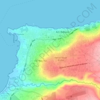
Name: Cité belle vue topographic map, elevation, terrain.
Location: Cité belle vue, Aïn Benian, Daïra Cheraga, Alger, 16202, Algérie (36.77607 2.89551 36.81607 2.93551)
Average elevation: 144 ft
Minimum elevation: -3 ft
Maximum elevation: 443 ft