
Quiriego topographic map
Interactive map
Click on the map to display elevation.
About this map
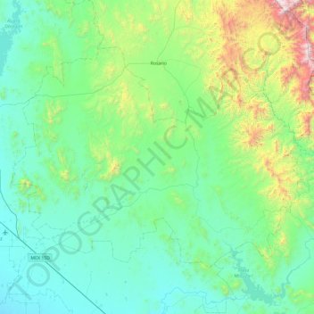
Name: Quiriego topographic map, elevation, terrain.
Location: Quiriego, Sonora, México (27.29679 -109.81384 27.88609 -108.86924)
Average elevation: 1,276 ft
Minimum elevation: 92 ft
Maximum elevation: 7,241 ft