
Town of Ossining topographic map
Interactive map
Click on the map to display elevation.
About this map
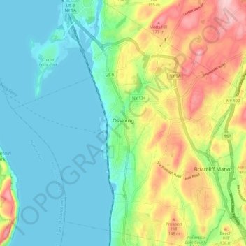
Name: Town of Ossining topographic map, elevation, terrain.
Average elevation: 213 ft
Minimum elevation: -7 ft
Maximum elevation: 659 ft
Other topographic maps
Click on a map to view its topography, its elevation and its terrain.
Village of Ossining
United States > New York > Westchester County > Town of Ossining
Village of Ossining, Town of Ossining, Westchester County, New York, 10562, United States
Average elevation: 200 ft
Spring Valley
United States > New York > Westchester County > Town of Ossining > Ossining > Spring Valley
Spring Valley, Ossining, Town of Ossining, Westchester County, New York, 10545, United States
Average elevation: 377 ft