Geolocate

Dortmund topographic map

Click on the map to display elevation.

About this map
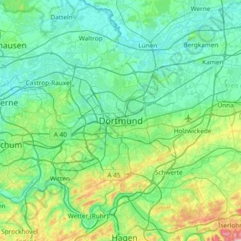
Name: Dortmund topographic map, elevation, terrain.

Location: Dortmund, North Rhine-Westphalia, 44135, Germany (51.35423 7.30528 51.67423 7.62528)

Average elevation: 367 ft

Minimum elevation: 138 ft

Maximum elevation: 1,499 ft

Gear up for your next adventure:

🥾Women's Hiking Boots - Top-rated trail boots with ankle support and superior grip
🛏️Cold Weather Sleeping Bag - Warm sleeping bag for cold conditions
🧭Outdoor Navigation Book - Learn advanced navigation skills
📡Handheld GPS Device - Reliable handheld GPS for outdoor navigation
🔦Compact Flashlight - Reliable flashlight for emergencies

As an Amazon Associate, this site earns from qualifying purchases at no extra cost to you.