
Bionaz topographic map
Interactive map
Click on the map to display elevation.
About this map
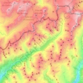
Name: Bionaz topographic map, elevation, terrain.
Location: Bionaz, Valle d'Aosta, Italia (45.83878 7.36458 45.98768 7.61076)
Average elevation: 8,760 ft
Minimum elevation: 3,648 ft
Maximum elevation: 13,599 ft
Other topographic maps
Click on a map to view its topography, its elevation and its terrain.
La Sengla
Italia > Valle d'Aosta > Bionaz
La Sengla, Bionaz, Valle d'Aosta, Italia
Average elevation: 10,325 ft