
Lier topographic map
Interactive map
Click on the map to display elevation.
About this map
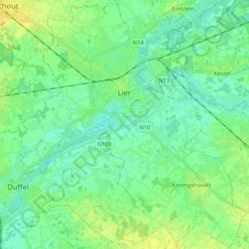
Name: Lier topographic map, elevation, terrain.
Location: Lier, Mechelen, Antwerp, Flanders, 2500, Belgium (51.07267 4.50585 51.16578 4.64306)
Average elevation: 26 ft
Minimum elevation: -7 ft
Maximum elevation: 69 ft
Other topographic maps
Click on a map to view its topography, its elevation and its terrain.
Heist-op-den-Berg
Belgium > Antwerp > Mechelen > Heist-op-den-Berg
Heist-op-den-Berg, Mechelen, Antwerp, Flanders, 2220, Belgium
Average elevation: 39 ft
Sint-Katelijne-Waver
Belgium > Antwerp > Mechelen > Sint-Katelijne-Waver
Sint-Katelijne-Waver, Mechelen, Antwerp, Flanders, 2860, Belgium
Average elevation: 20 ft