
Monte Guadagnolo topographic map
Interactive map
Click on the map to display elevation.
About this map
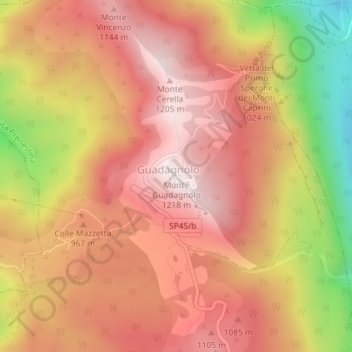
Name: Monte Guadagnolo topographic map, elevation, terrain.
Location: Monte Guadagnolo, Capranica Prenestina, RM, LAZ, Italia (41.91310 12.92854 41.91320 12.92864)
Average elevation: 3,091 ft
Minimum elevation: 1,608 ft
Maximum elevation: 3,937 ft